Arkhangai Province
- NationMongolia
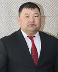
- Government NameMiskha Batjargal
- GovernorB.Tserennadmid
Symbol
Coat of arms
History
- The Arkhangai Aimag was established in 1725, entitled to Sain Noyon Khan Aimag. After the victory of the People’s revolution, it was renamed to Tsetserleg Mandal Uuliin Aimag in 1923, followed by Arkhangai Aimag in 1931.
Topographic Feature
- The area of Aimag is divided into three regions: high mountain, forest steppe, steppe. It borders the Khobsgol to the north; Uvurkhangai Aimag to the northeast and east; Bayankhongor Aimag to the southwest; and Zabkhan Aimag to the northwest.
- The average height is 2,414m above sea level. The highest place is Kharlagtain Saridag of 3,539m, and the lowest place is Okhon Tamiriin Belchir of 1,290m. The beautiful northern Khangai Region is full of high mountains, wide canyons, clean lakes, long rivers, colorful flowers, delicious fruits, birds, and wild animals.
Basic Information
| Contents | |
|---|---|
| Geography/Climate |
|
| Population(2021) |
|
| Major events |
|
| Major events |
|
| Sisterhood & Friendship Provinces / Cities |
|
Economic Status
| Contents | |
|---|---|
| Economy(2021) |
|
Others
- Contact:Administrative management department
- Address:Government office of Arkhangai province
- Tel.:+976-7033-3231
- Fax.:+976-7033-3208
- Official Website : www.arkhangai.gov.mn